Lake George
The Last of the MohicansLake George, called the Horican in the narrative, is both a vital passage through the northern frontier and a landscape whose names record competing claims to the land. Its waters join the military route between Lake Champlain and the Hudson, while the novel’s account links the lake to Indigenous dispossession, wartime movement, and the changing uses of the surrounding wilderness.
Names and Indigenous Geography
The novel’s preface openly explains that the name Horican is an authorial invention rather than a name faithfully recorded from Natty Bumppo. The author chose it because the French name, Lac du Saint Sacrement, seemed cumbersome, the English name Lake George commonplace, and the Indigenous name difficult to use familiarly in fiction. An old map supplied the name of a people the French called Les Horicans, whom the author understood to have lived near the lake; he then placed the fictional name in Natty Bumppo’s speech. The preface acknowledges the invention and allows the name to stand.
The historical geography beneath that fictional choice is itself presented as layered and contested. French missionaries called the water Lac du Saint Sacrement, associating it with baptism; the English named it for their reigning prince. The narrator says that both names displaced the Indigenous right to preserve the lake’s original appellation, Horican. A note explains that the people living on its banks used a descriptive name meaning “The Tail of the Lake,” because Lake George forms a tail to Lake Champlain when seen on a map. The competing names thus make the lake a record of successive acts of religious and political naming, as well as of an Indigenous claim that colonial names overlaid.
Landform and Strategic Passage
The lake is described as a long, island-studded body of water set among mountains, extending south from Lake Champlain. At its southern end, a high plain interrupts the waterway; a portage of several miles then leads to the Hudson, where rapids once limited navigation. In the other direction, Lake Champlain reaches from the Canadian frontier deep into New York, creating a natural route for French forces moving south. The linked waters and overland passage made the district a military corridor rather than an isolated scenic setting.
The narrative characterizes the region between the upper Hudson and the neighboring lakes as a principal arena of colonial conflict. Forts were built at points controlling the route, repeatedly captured, destroyed, and rebuilt. Armies entered the forests in campaigns that often ended in defeat and retreat. The lake’s geography therefore determines the broad strategic setting: control of its approaches and connected waterways mattered to the struggle between French and English forces for the colonies.
Routes, Pursuit, and Refuge
The lake also structures the characters’ movement. The road between the military posts at its southern end and the fort on its shore was less than five leagues; a rough path had been widened for wagons. When news arrived that Montcalm was advancing up Lake Champlain, Munro requested reinforcement from Webb, whose forces lay at Fort Edward. The lake was thus part of the approach by which the French army threatened the English-held fort, and the short land connection between the posts framed the question of relief.
Later, Lake George becomes a route of cautious travel and pursuit. After moving through its narrow passages at dawn, the travelers thread among numerous small islands, wary that enemy scouts may be concealed along the channel. In the narrows, the many islets leave some passages only a few feet wide; elsewhere the lake varies from one to three miles in breadth. Chingachgook watches the rocky shores and wooded heights while Uncas and Hawkeye help propel the canoe through crooked channels. The same landscape that offers concealment and passage also exposes travelers to ambush.
After the pursuit, the party does not take the most direct course toward the western shore. The wary Mohican steers toward the hills behind which Montcalm has led his army to Ticonderoga, maintaining this detour for hours before landing near the lake’s northern end. The episode shows how local knowledge turns the lake’s bays, islands, and headlands into tactical choices. Elsewhere, its shore near the spring at Ballston is identified by the narrator as the site of the preceding incidents, linking the waterside journey to a place later known as a fashionable watering destination.
War, Settlement, and Historical Change
The narrative places the lake within a landscape that changes sharply over time. At the time of the preface, roads cross forests that once had no paths, villages occupy parts of the region, and the fortifications at William Henry survive only as ruins. Yet much of the wilderness remains, even as Indigenous people have deserted this part of the state. The author describes only a few Oneidas remaining on reservations in New York among the peoples named in the book, while the others have disappeared from their former regions or altogether. The lake’s later accessibility and settlement therefore coexist with the profound displacement of its earlier inhabitants.
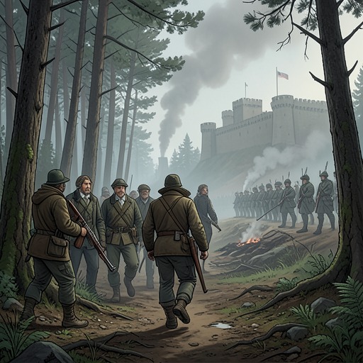
The war leaves a contrasting record on its shores. On the night of August 9, 1757, French and English forces lie opposite one another near the lake after the fort’s capture. By the third day after that event, the French camp has been abandoned and the fort is a smoldering ruin amid damaged artillery and masonry. A premature cold and storm alter the landscape, while the lake’s previously calm, crowded surface gives way to rough water. This change makes the shore a material record of military destruction, not merely a backdrop to it.
The lake’s significance rests in this conjunction of routes and histories. Its waters make movement possible for armies and fugitives, its narrow channels reward detailed knowledge, and its successive names expose the political erasure involved in colonial possession. The later road, village, and ruin do not erase the earlier geography; they make the lake a setting in which strategic control, Indigenous displacement, and historical memory remain visible together.